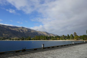
Arriving in the small village of Kingston at the head of Lake Wakatipu, the scenery glows majestic in the sunshine. The railway once came here, connecting with the ferry at Queenstown. The station is now a cafe and many of the old trains are a heritage attraction. Wandering along the jetty, nothing stirs. It’s debatable if anyone lives here, it’s so beautifully quiet.

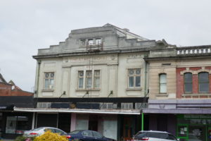
Heading south the landscape becomes less mountainous and increasingly agricultural. Cattle, sheep and elk dot the fields and hillsides. Towns and villages are few and far between. All have wide main streets composed of solid, old buildings, many with the original names set large in relief on the front. Although obscured by paint and plastic signage, there’s no escaping the former importance of some of these towns. Today shops are boarded up or converted to ‘Op shops’ (Opportunity or charity shops) as are many in the UK.

Shopping is not a pastime here. Clothes shops are rare and the contents depressing. By contrast the saddlery is impressive and the range of quad bikes in the Honda dealership bewildering. This is solid farming country. Most vehicles are muddy 4×4 pickups. And they work for a living.

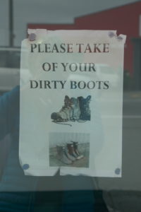
Stopping for a mooch, we spot a ‘Southland’ courtesy. Outside every cafe or store, muddy boots sit looking like obedient dogs. Inside, their owners are padding round in their socks. Some stores have signs, but no-one minds. It’s expected. The dogs? Well they are still in the back of the pickup, of course !
We are advised to drive through Invercargill. Nothing to see here. Although this must have been some place. The architecture is largely Victorian, imposing and quite grand, but again, it’s been covered over or neglected in the name of progress. I think of Napier and its’ Art Deco buildings. It would seem there are at least as many interesting buildings here. Tempting though it is to stop, we keep to the plan.
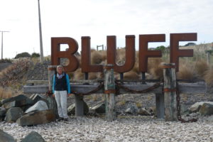
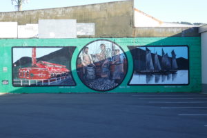
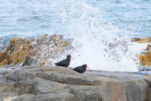
30 minutes further on is Bluff. A small town at the southernmost tip of South Island, it has a big reputation for locally caught ‘Bluff oysters’.* A delicacy, we’re alarmed to discover many are eaten covered in batter. My friend defiantly orders them ‘au naturel’. The commercial port dates from the 1960s to handle the cargos of wood, aluminium, wool, tallow and fish and shellfish. It’s a bleak place. Bluff’s Maritime Museum gives insight into the town which was founded on sealing and then whaling. Seems everywhere I go this is the case ! 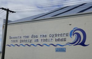
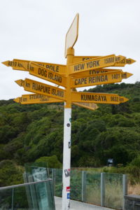
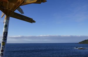
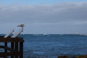
Exploring further we reach the end of State Highway 1, Stirling Point. Nominally the southernmost part of the mainland, it’s marked with a signpost pointing every which way. Popular for selfies, the views across the huge sandbar at the harbour entrance are superb.
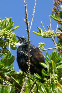
Our soundtrack to the last few days has been noisy and crazy birdsong, haphazard as though improvised. Think ‘Clunk’ in Dick Dastardly. Wondering if several birds are responsible, my pal spots the originator. It’s a Tui or parson bird**. A national icon, this native sounds like it’s on a weird cocktail of hallucinogenics and just doesn’t care. We watch it for ages, trying not to laugh.
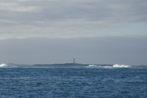
Dog Island, just offshore, sports the tallest lighthouse in New Zealand. A fine black and white striped tower, it was built by one of the Scottish Stevenson family, such is it’s importance to Bluff. In another link to my travels, I discover it’s so called as it was used to quarantine expedition dogs being sent to Antarctica. A few smaller islands litter the horizon.

Round the corner and hazy in the distance is Stewart Island; tomorrow’s destination. The ‘third island of New Zealand’ it is largely protected reserve although there is a small town, Oban. Planted firmly in the Southern Ocean’s track around the globe, it’s a remote and rugged place. And I can’t wait.
*https://www.nzgeo.com/stories/dire-strait-bluff-oysters/
** Just Google ‘Tui bird’